You are viewing a single thread.
View all comments
26 points

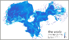
Maybe I’m not understanding. Isn’t Australia an island, so wouldn’t it show as some kind of “lake” like new Zealand is?

permalink
report
reply
29 points

I was confused as well and I found this coloured version and this version with sea connections (green for Panama and Suez canal) that helped me to understand!

permalink
report
parent
reply
12 points

Thank you.

Still kinda a weird how they have it laid out. Granted I’m no cartographer, I don’t know the struggles of projecting a sphere on a plane.

permalink
report
parent
reply
3 points

The Continental divides split the continents in half as there’s no water that goes fully over them. That’s awesome!

permalink
report
parent
reply
1 point

oh yes now i get it

permalink
report
parent
reply
3 points

Every continent is an island

permalink
report
parent
reply
5 points

Europe and Asia claim otherwise.

permalink
report
parent
reply
11 points
*

That’s because they’re only fake continents who don’t realize they’re just parts of Afro-eurasia.

Hell, Europe is just a peninsula with delusions of grandeur.

permalink
report
parent
reply
2 points

Here’s a better projection. I don’- know what went wrong with OP’s…

permalink
report
parent
reply

MapPorn

!mapporn@lemmy.world

Create post

Discover Cartographic Marvels and Navigate New Worlds!

Rules

  1. Be respectful and inclusive.
  2. No harassment, hate speech, or trolling.
  3. Engage in constructive discussions.
  4. Share relevant content.
  5. Follow guidelines and moderators’ instructions.
  6. Use appropriate language and tone.
  7. Report violations.
  8. Foster a continuous learning environment.

Community stats

  • 1

    Monthly active users

  • 97

    Posts

  • 980

    Comments