


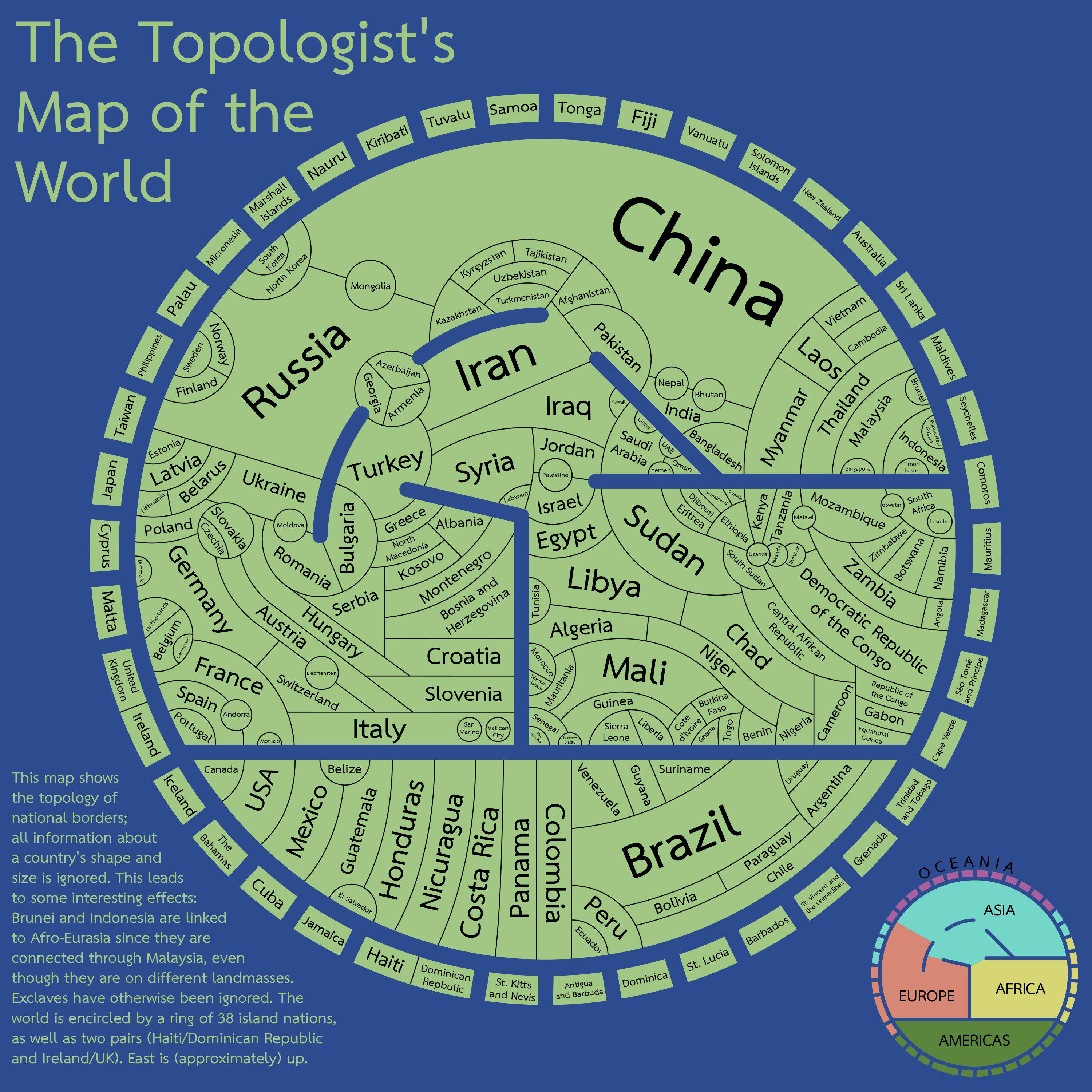
Who’d have thought that Isidore of Seville was actually a topologist fifteen hundred years ahead of his time

Interesting that this map does have Palestine (presumably the West Bank and east Jerusalem) but doesn’t consider Gaza part of Palestine.
That’s quite a unique combination.
Edit: looking at Azerbaijan, I think they just focus on the biggest landmass and ignore exclaves.
Edit2: the fine print actually says that they ignore exclaves, except for Malaysia.
Maybe it’s just considering de facto control? Israel currently controls the whole Egypt-Palestine border, so there’s no land controlled by any form of Palestinian government that has a border with Egypt
Edit: or it’s an artifact of the “exclaves have otherwise been ignored” part, if the West Bank is considered the core and Gaza is an exclave of that
Like all maps, this one needs a date. For example, Canada and Denmark now share a land border (Hans island)
Bolivia shares a border with Argentina. They got that wrong on this map.
And Paraguay does not share a border with Chile. Some South American shenanigans to be sure.
France has a land border with Brazil - in fact, it’s its longest border with any country. But I realize that non-contiguous countries pose quite a challenge for this type of layout.
proof that russia is just a buffer state between norway and north korea
